Subject: Midwestern and Western United States
Period: 1861/1865 (dated)
Publication: General Atlas
Color: Hand Color
Size:
14 x 11.5 inches
35.6 x 29.2 cm
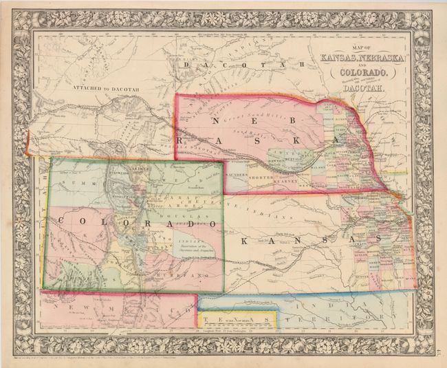
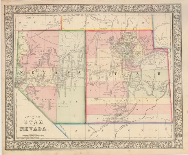
Both of these colorful maps feature Mitchell's handsome first edition border with flowers and roses. Dated 1861 and 1865, but both published circa 1866.
1. This great map details Kansas, Nebraska and Colorado and the southern portion of Dakota. Counties, cities, towns, transportation routes, Reservations, and topographical features are illustrated. County development in Kansas stops at Ft. Atkinson, and in Nebraska the northern portion is unorganized. In Colorado the Gold Region is noted adjacent to Denver City. This early edition has not yet labeled the newly formed Wyoming Territory, still referring to the area as "Attached to Dacotah."
2. This map has good detail throughout as it delineates the Central Pacific Railroad, the Emigrant Road to California, a portion of the Emigrant Road to Oregon, the under-construction wagon road from Red Bluffs to the Owyhee mines, and the Hastings Road across Utah. Indian tribes, gold and silver mines, the Telegraph route, Lake Tahoe, and much more are located.
References:
Condition: A
Both have full margins, good impression and fine original hand coloring. The are very good even considering a spot or two.