Subject: Colonial Midwest
Period: 1778 (circa)
Publication: Atlante Novissimo…
Color: Hand Color
Size:
16.5 x 12.5 inches
41.9 x 31.8 cm
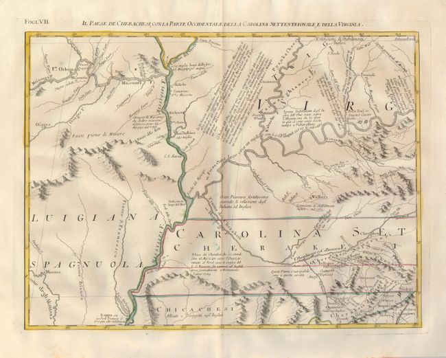
This map provides a detailed view of the forks of the Missouri and Ohio Rivers along the Mississippi and adjacent areas. While the map is filled with Indian villages, it shows very little European settlement other than a couple of French forts and Dr. Thomas Walker's settlement. Dr. Walker, surveyor for the Ohio and Loyal Land Companies, led a small group into the area in 1750 and established a supply post in the area of present-day Barbourville, Kentucky. Several blocks of explanatory Italian text cross the map. This is one sheet of Zatta's version of John Mitchell's epic map. The whole map, titled "Le Colonie Unite dell' America Settentrle," was published as a set of twelve individual maps. Each sheet stands on its own and has full borders.
References: Portinaro & Knirsch, plt. CL; Sellers & Van Ee #163.
Condition: A
Beautiful, early impression and fine outline color on hand laid paper with wide margins and two large watermarks.