Catalog Archive
Auction 128, Lot 257

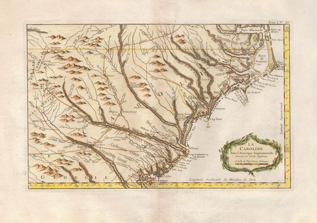
"La Caroline dans l'Amerique Septentrionale Suivant les Cartes Angloises", Bellin, Jacques Nicolas
Subject: Colonial Southeast

Period: 1764 (published)

Publication: Petit Atlas Maritime

Color: Hand Color

Size:
14 x 9 inches
35.6 x 22.9 cm
Download High Resolution Image
(or just click on image to launch the Zoom viewer)

This wonderful map shows a rather compressed rendition of the coastline of both Carolinas, from Albemarle Sound (Baye Albermarle) and Pamlico Sound (Baye de Panticoe) at the north to St. Helene Sound and Augusta, Georgia to the south. Along the way are many recognizable settlements, rivers and other landmarks, including: Cap Hatteras, Cap Fear, Charles Town, New Bern, the Little and Grande Pedee Rivers, George Town and Edisto Island. Several roadsl ead to the interior Cherokee villages. A fine pre-Revolutionary War map of the coastal Carolinas. Decorative cartouche .

References: Cumming (SE) #342.

Condition: A+

Beautiful example with later color.

Estimate: $500 - $600

Sold for: $375

Closed on 5/20/2009

Archived