Subject: Colonial Southeast and Bermuda
Period: 1744 (published)
Publication: Oldmixon's "Das Britishce Reich in America…"
Color: Black & White
Size:
10.3 x 7 inches
26.2 x 17.8 cm
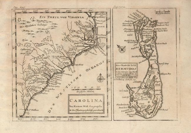
Derived from the important Gascoyne map of 1682, the primary map covers the coast from Cape Henry to B. St. Matheo. In the vicinity of Charlestown are small icons each representing one of the numerous plantations. The map is a newly engraved copy of the Moll/Oldmixon map of 1708 with legends and place names added in German. On the page at the right is a map of Bermuda engraved within it's own neatline. Moll, a Dutchman living in England since 1680, was "the most prolific designer and publisher of maps of Carolina" and was "as open and effective a protagonist for British territorial claims in North America as was Delisle for the French."
References: Cumming (SE) #260.
Condition: B+
On a full sheet of hand laid paper with deckle edges. Fine, dark impression. A little light foxing visible at left, otherwise a near fine example.