Subject: Mid-Atlantic United States
Period: 1899 (dated)
Publication:
Color: Printed Color
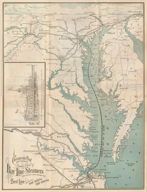
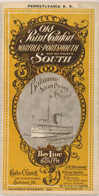
This unusual ten-panel folding timetable features the map on two-thirds of the verso. The map is drawn in a most unusual manner: the lower portion is presented typically, but as it travels northward the map morphs into a birds-eye projection with the horizon at Philadelphia and Harrisburg. The larger cities are shown as complex icons with dense buildings. Shows all of Chesapeake Bay and extends from Suffolk and Norfolk in the south, north to Baltimore and Philadelphia, and westward to include Richmond and Harper's Ferry. The large inset "The New Terminal…Where Southbound Passengers Embark" is a well rendered engraving of the large station building. Fancy Victorian-style titling. One panel describes the steamships of the fleet, including the Alabama, Georgia, Tennessee and the Virginia. The remaining panels are involved with schedules and timetables. Self-folds into yellow and back printed cover with decorative elements and a photograph of a ship under a full head of steam. The cover is titled "Pennsylvania R.R. Old Point Comfort Norfolk-Portsmouth and all Points South Baltimore Steam Packet Company Bay Line Best Line South." Dated November-December, 1899 on the cover. Printed by the Baltimore firm of E.B. Read & Son.
References:
Condition: B+
A couple short fold splits and a couple small fold intersection splits.