Subject: United States
Period: 1890 (published)
Publication: 11th Census, Report of Indians Taxed and Indians Not Taxed
Color: Printed Color
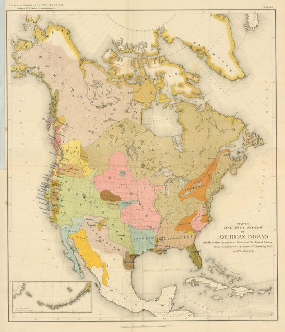
1) 11th Census, Report of Indians Taxed and Indians Not Taxed, 1890, J.W. Powell. This colorful map was based on a similar map published in the Annual Report of Bureau of Ethnology. It is a useful map for someone interested in understanding the possible early relationships of the various Native American Tribes. Small inset of the Aleutian Islands at lower left. Chromolithographed by the New York firm of Sackett & Wilhelms. (17.3 x 20.3") Folding as issued. A beautiful, fine example except for two small spots in margin at left. (A)
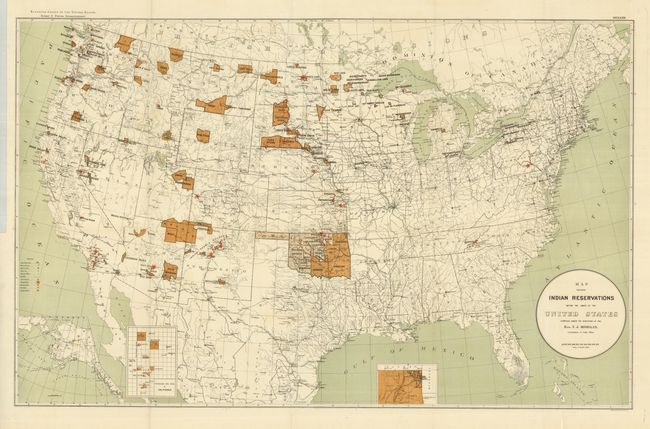
2) This large map of the United States focuses on the many Indian Reservations in the United States in 1894. The reservations are named and shown in dark brown overprinting. Inset maps are used where the reservation concentration prevents them showing well on the main map. Insets include Indian Territory, the Mission Indian Reservations in California, and the Territory of Alaska. Extensive legend locates Military Stations, Capitals, County Seats, Railroads, Indian Agencies, Training Schools, Boarding Schools, Day Schools and Contract Schools. Printed by Sackett & Wilheims Litho Co., New York. A large and very detailed map filled with information. (33 x 21") Folding as issued. Fine. (A+)
References:
Condition:
See description.