Subject: North America
Period: 1855 (dated)
Publication: Atlas of the World
Color: Hand Color
Size:
12.8 x 15.5 inches
32.5 x 39.4 cm
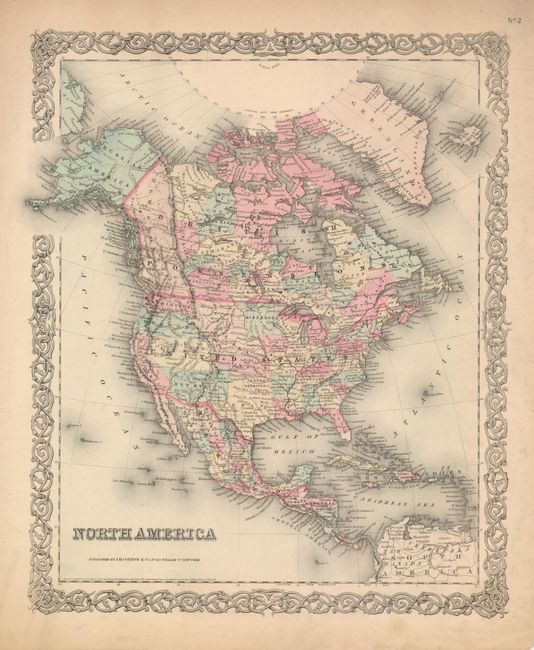
In this attractive steel engraved map the borders and territories are some of the most interesting during the development of the West. The map is filled with political and topographical detail and graphically indicates the rapid changes taking place during this period. The large New Mexico Territory extends between California and Texas, Alaska is Russian America, Nebraska stretches between the Continental Divide and Minnesota and north to the Canadian border. Minnesota includes much of the future Dakota territory, bordering the Missouri River. Both Washington and Oregon extend to the Continental Divide, and "Kanzas" reaches the Rocky Mountains at its boundary with Utah. Oklahoma is entirely Indian Territory. No sign of Nevada, Arizona, Colorado, Montana, Wyoming, or the Dakotas. Excellent detail throughout Canada and Mexico with all states named and individually hand colored. Names Indian nations, forts, rivers, etc. Colton's signature scroll-style border surrounds.
References:
Condition: A
The map image is near fine, but the wide margins have soiling, staining at right, and toning. One chip along upper margin and the lower right tip has a very small portion of paper missing from old crease.