Subject: Cartographic Reference
Period: 1980-87 (published)
Publication:
Color:
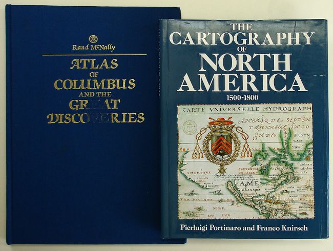
1) The Cartography of North America, by Pierluigi Portinaro and Franco Knirsch, Greenwich, Ct, 1987, is a nicely illustrated cartographic reference with biographical sketches of major cartographers. It presents reproductions of authentic maps from the first three centuries of the mapping of North America reflecting an unfolding story of daring exploration, tenacious settlement, and fierce colonial rivalry. 320 pp. containing 180 extensively captioned maps, nearly all in full-color and over 90 supplementary illustrations. Published by Chartwell Books, Edison NJ, 1987. Hardbound in blue cloth with dust jacket. 13 x 10". Grade A+. Minor shelf wear along bottom edge, otherwise as new.
2) Atlas of Columbus and The Great Discoveries, by Kenneth Nebenzahl, illustrates a selection of the most significant materials of the period, beginning with the world as known to Europeans before Columbus' first voyage. More than 100 color illustrations depict maps by Ptolemy, Pizzagano, Martellus, Waldseemuller, Mercator, Hondius and others. 168 pp., with index & bibliography. (11.3 x 14.8") Rand McNally, 1980. Hardbound in blue cloth with title in gilt. Grade A. Some soiling and wear to the front cover, with some loss of the gilt title.
References:
Condition:
See individual descriptions.