Catalog Archive
Auction 127, Lot 737

"A General Map of the East Indies and that part of China where the Europeans have any Settlements or commonly any Trade", Kitchin, Thomas

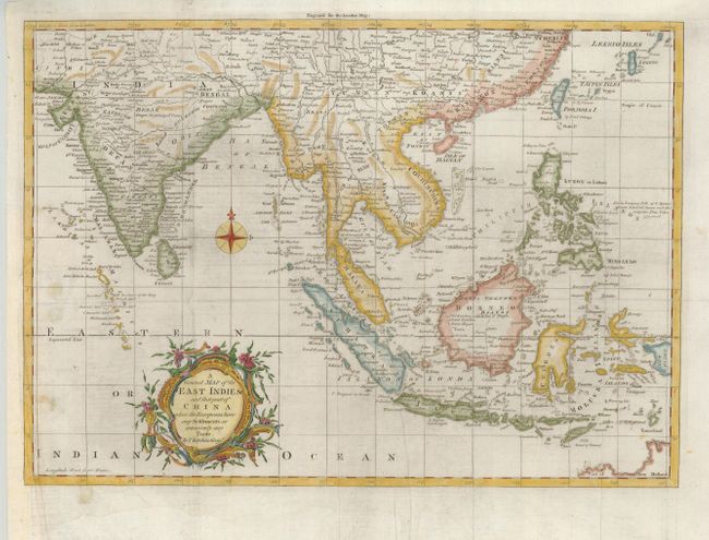
Subject: South East Asia

Period: 1761 (published)

Publication: London Magazine

Color: Hand Color

Size:
16.5 x 11.7 inches
41.9 x 29.7 cm
Download High Resolution Image
(or just click on image to launch the Zoom viewer)

Finely engraved and detailed map covering from India through southern China and all of the East Indies and the Philippines. The map is very detailed with many small islands named. European trade with Asia and the East Indies was rapidly increasing during the mid-1700s, and this map reflects the importance of the region. A decorative floral title cartouche and compass rose add to the delicate composition.

References: Jolly, LOND-203.

Condition: B+

Issued folding, now flattened with the binding trim at left extended to better accommodate framing. A short binding tear into the border has been expertly repaired.

Estimate: $200 - $250

Sold for: $150

Closed on 2/25/2009

Archived