Subject: Eastern Europe
Period: 1552-54 (published)
Publication: Cosmographia.
Color: Hand Color
Size:
13.5 x 10 inches
34.3 x 25.4 cm
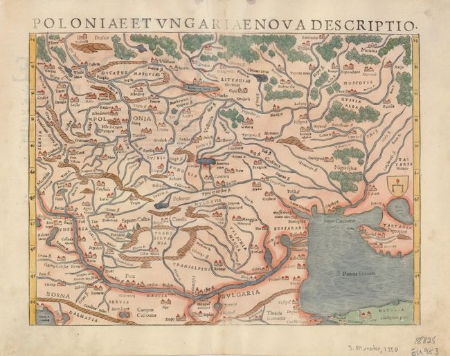
Woodblock map of the region containing present-day Romania, Moldova and Ukraine, with parts of Poland, Slovenia and Hungary. It has fine graphic depictions of the rivers, mountains, forests, and towns, with many ancient place names. The map covers the region from Prussia at upper left to Constantinople and the Black Sea at lower right and names Silesia, Bosnia, Dalmatia, Serbia, Bulgaria, Moscovia, Tartaria and much more. Latin text on verso.
References:
Condition: A
An exceptional example with a very nice, dark impression, fine full period-correct coloring and full margins. Expert, invisible repair to centerfold, otherwise fine.