Catalog Archive
Auction 127, Lot 418

"Carte de la Guiane Francaise & Hollandaise", Tardieu, Jean Baptiste Pierre

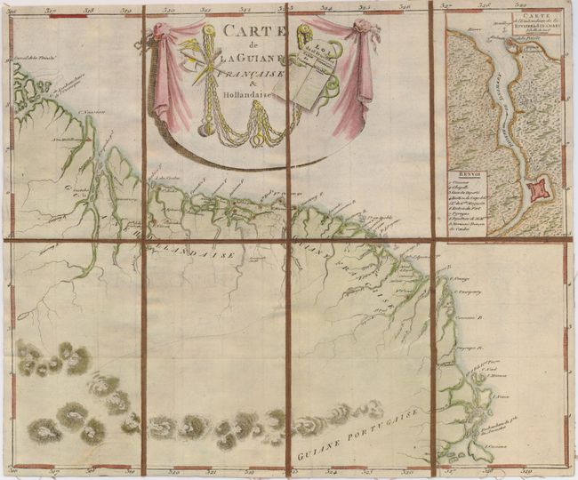
Subject: Guyana, Suriname, French Guiana

Period: 1804 (circa)

Publication:

Color: Hand Color

Size:
14 x 11.5 inches
35.6 x 29.2 cm
Download High Resolution Image
(or just click on image to launch the Zoom viewer)

This scarce map illustrates the Dutch, French and Portuguese possessions in Guyana. An inset shows the French forts at the mouth of the Sinamary River. The map locates several Dutch and French forts along the coast. The title cartouche contains the French Republican calendar, used by the French government for about twelve years from late 1793 to 1805. Dissected and backed with contemporary brown linen with title in brown manuscript ink on a paper label.

References:

Condition: A

Some minor creasing from mounting, else very good.

Estimate: $180 - $220

Sold for: $130

Closed on 2/25/2009

Archived