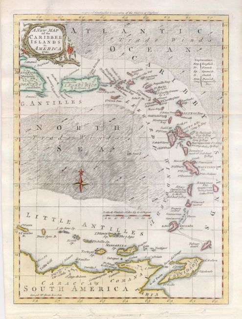
Subject: Lesser Antilles
Period: 1761 (dated)
Publication: Smollet's Continuation of the History of England
Color: Hand Color
Size:
7.2 x 9.5 inches
18.3 x 24.1 cm
This very attractively designed chart shows the West Indies from the eastern portion of Hispaniola to include the Little Antilles, Trinidad and a portion of northern South America. Legend identifies colonial ownership plus lands conquered by England. The rococo-style title cartouche and compass rose are both hand colored. The seas are fully engraved with arrows indicating the prevailing winds. A handsome small map of the Caribbean published near the end of the French and Indian Wars.
References: Sellers & Van Ee #1725.
Condition: A
Very nice example on thick hand laid paper. There is a small area of abrasion in border above cartouche and some binding holes in lower margin well away from map border, otherwise fine.