Catalog Archive
Auction 127, Lot 364

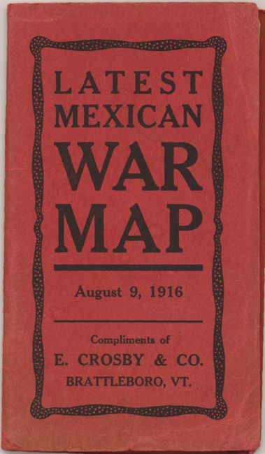
"[Lot of 2] Latest Mexican War Map [and] Gulf Coast Lines…",

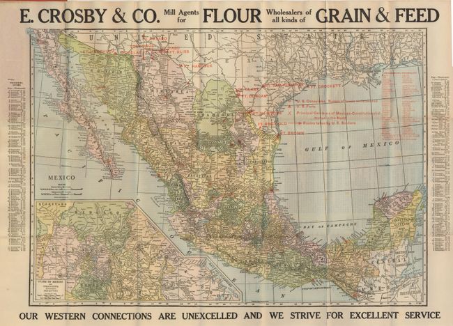
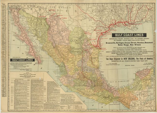
Subject: United States & Mexico

Period: 1916 (dated)

Publication:

Color: Printed Color

Size:
See Description
Download High Resolution Image
(or just click on image to launch the Zoom viewer)

Two maps published during the Mexican War. This little known war and the Army's efforts to find Pancho Villa are well described here.

1) ... August 9, 1916 Compliments of E. Crosby & Co. Brattleboro, VT. (18.8 x 13"). This advertising pocket map uses overprinting to locate forts along the border, routes of marches, a Spanish pronouncing vocabulary. On verso is the "Summary of the Mexican Situation" which lists all events from February 16, 1913 to June 21, 1914. Folds into red wrappers (3.5 x 6"). Map is very good less some fold intersection splits closed on verso with archival tape. (B+)

2) Rand, McNally, Chicago, 1916, (26.5 x 19"). This folding map uses overprinting to show railroad routes along the Gulf, forts along the border, and more. In the inset is "Mexican Events 1916" which lists scores of events from March 13th to June 29th. Inset information continues on "The Mexican Army and Navy", "Personnel of the United States Army and Navy" and the "Vessels of the Navy" (total 632). The railways are in bold red within the southern half of Texas with all stations named. Blank verso. Some fold splits two with small loss, good impression and color. (B)

References:

Condition:

See individual descriptions.

Estimate: $80 - $120

Sold for: $80

Closed on 2/25/2009

Archived