Catalog Archive
Auction 127, Lot 35

"Ptolemaisch General Tafel Begreissend die halbe Rugel der Weldt", Munster, Sebastian

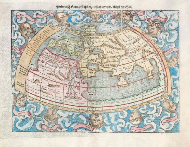
Subject: Ancient World

Period: 1550 (circa)

Publication: Cosmographia

Color: Hand Color

Size:
13.5 x 10 inches
34.3 x 25.4 cm
Download High Resolution Image
(or just click on image to launch the Zoom viewer)

This woodcut, Ptolemaic world map is surrounded by clouds and eleven wind heads (with their names shown in the banners). The continents are oddly shaped and all connected by a great southern continent Terra incognito secundum Ptolemaeum. There is a very large Taprobana (modern day Sri Lanka) in the Indian Ocean, and the Indian subcontinent is severely truncated. Only the northern part of Africa is shown with the Nile originating from a series of lakes in a large mountain range. German text and an elaborate woodcut on verso.

References: Shirley #76.

Condition: A

There are small binding holes in the blank margins.

Estimate: $950 - $1,200

Unsold

Closed on 2/25/2009

Archived