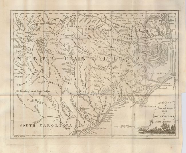
Subject: Colonial North Carolina
Period: 1779 (published)
Publication: Universal Magazine
Color: Black & White
Size:
14 x 10.5 inches
35.6 x 26.7 cm
This scarce map of North Carolina published during the American Revolution, is apparently based on Henry Mouzon's 1778 foundation map of the region. It is filled with details including rivers, early settlements, and a number of court houses. The counties are named but their boundaries are not delineated. The Old Boundary Line of South Carolina is noted. The title is enclosed in an attractive landscape style cartouche. Published in the October, 1779 issue of this London-produced magazine.
References: Jolly UNIV-182; Sellers & Van Ee #1501
Condition: B+
Near fine example less some light offsetting. Dark, early impression and full margins. Folding and binding trim, as issued.