Subject: Midwestern United States
Period: 1882 (published)
Publication:
Color: Printed Color
Size:
27 x 13 inches
68.6 x 33 cm
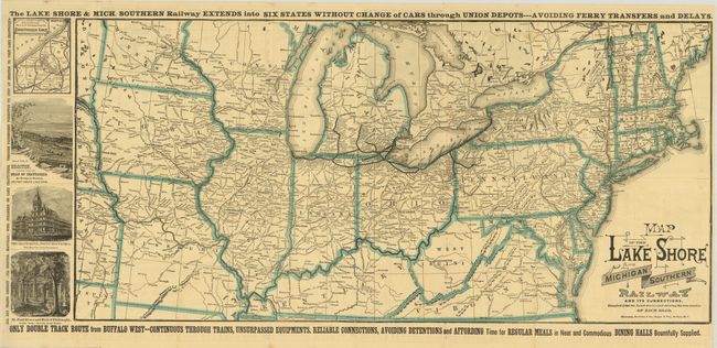
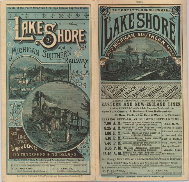
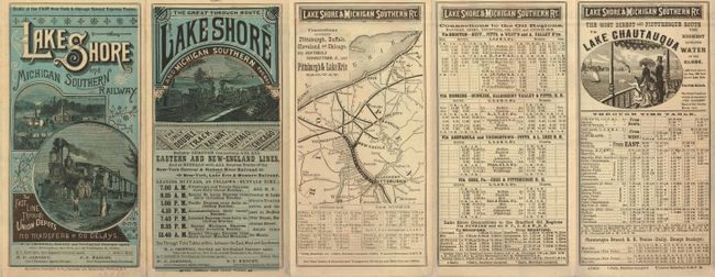
This uncommon railway map details the routes between Buffalo and Chicago with side routes into Michigan. It also shows rails to Youngstown and Oil City in Pennsylvania. The map extends to the Missouri River to include all of Iowa and Missouri, and east to show the entire eastern seaboard from Norfolk up to Bangor, Maine. The map has four vignettes at left: Map Showing the Railway Connections to Chautauqua Lake; and views of the Hills of Chautauqua with locomotive in the foreground; The Grand Hotel, Point Chautauqua; and St. Paul Grove and Hall of Philosophy. The railroad advertises itself as the "Only Double Track Route from Buffalo West" with "Regular Meals in Neat and Commodious Dining Halls Bountifully Supplied." Fancy titling. On verso is the timetable with engraved view and a second map detailing the route between Youngstown and Pittsburgh. Self-folds into blue colored panels featuring engraved locomotives and fancy titling. Dated Aug. 25, 1882.
References:
Condition: A
Folding as issued. Four tiny pieces of archival tape at fold intersections.