Subject: Midwestern United States
Period: 1850 (dated)
Publication: Mitchell's New Universal Atlas
Color: Hand Color
Size:
16 x 13 inches
40.6 x 33 cm
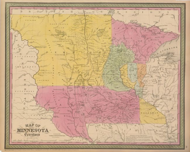
This well engraved map is an early example of Young's notable map. This edition has county development limited to the extreme southern and eastern portions of the territory, reflecting a date circa 1851. The large region in the west is labeled Pembina, while the large southern area is Dakotah. Settlement is almost exclusively along the Mississippi River. Many Indian tribes are located, including the Assiniboine, Yanktonan, Chippeway, Mennomonees, Winebagoes, etc. Forts along the Missouri River include aux Cedres, Lookout, Pierre Choteau, Clarke, and Mandan (noted as the wintering place of Lewis and Clarke in 1804-05). Fancy titling and decorative borders. This detailed and interesting map documents the early stages of development of Minnesota and the Dakotas. Dated 1850 but contains a notation referring to the Sioux Treaty of 1851.
References:
Condition: A
The map image is fine with lovely original coloring and crisp impression. Marginal toning, otherwise fine.