Subject: Mid-Atlantic United States
Period: 1783 (circa)
Publication: Atlas moderne portatif
Color: Black & White
Size:
8.5 x 6.8 inches
21.6 x 17.3 cm
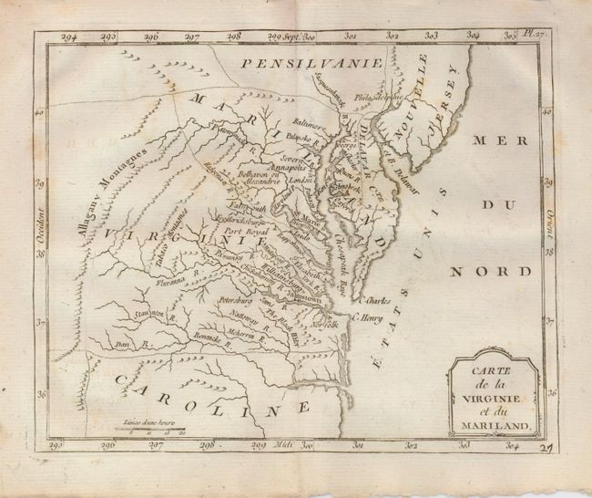
This unusual map of the Mid-Atlantic region exhibits some very odd boundaries. Maryland is an ill-defined wedge between Virginia and Pennsylvania and does not extend beyond the Allagany Montagnes. Maryland's most prominent settlement is St. Marie, the colony's first capital. Delaware is named Delaware Cte. and Alexandria is also called Belhaven. Many interesting areas are located including the Tabaco Mtns, Jamestown, and Annapolis. This is a variant of the Laporte map, with the addition of Etats Unis in the Atlantic, rather than Possesions Anglois, but it is not the 1799 Berthelon issue with the simpler cartouche.
References:
Condition: A
A few light foxing marks, otherwise near fine. Full margins with deckle edges.