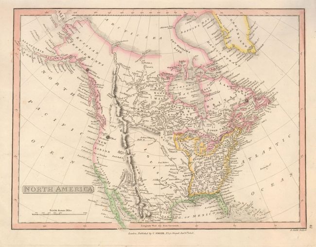
Subject: North America
Period: 1808 (dated)
Publication: General Atlas
Color: Hand Color
Size:
14 x 10 inches
35.6 x 25.4 cm
Dated 1808, this uncommon map shows North America immediately prior to the discoveries of Lewis and Clark. It depicts a pre-Humboldt configuration for the Rockies, limited knowledge of Louisiana Territory and the northwest coast based upon Cook and Vancouver. California is New Albion and Upper California includes several missions. The Baja is California and western Mexico is New Navarre. In today's Texas are the towns of Cenis, Texas, S. Antonio and more. Locates Santa Fe and shows the Colorado River coursing mostly straight south toward the Gulf of California. The Great Basin is completely devoid of features. Salt Lake is Pearl Shell Lake. The massive Western Territory extends from Pennsylvania. Alaska is Russian Settlements and the Aleutian Chain is well shown but is labeled Alyanska. A fascinating map with many early place names.
References:
Condition: A+