Subject: North America
Period: 1700 (dated)
Publication:
Color: Hand Color
Size:
23.8 x 18 inches
60.5 x 45.7 cm
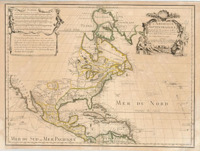
This historically important foundation map made three significant contributions to the cartography of North America. It was the first map to revert back to the peninsular form for California, even before the publication of Kino's report. Although on close inspection one can see a small gap at the head of the Gulf of California, leaving open the possibility that California might still be an island. Delisle's second contribution to North American cartography was a more accurate rendition of the Great Lakes region. Third, Delisle corrected the position of the lower Mississippi River, moving the mouth of the river from an area near Galveston Bay to a more correct location in Louisiana. That third contribution was first made on the second state of the map (see Mercator's World article), which is the state of this example.
References: Mercator's World Vol. 6, No. 4, pp. 44-49; Tooley (Amer) p. 18, #28; Wheat [TMW] #79.
Condition: B
Original outline color. Toned with some light damp stains and a couple of minor old repairs.