Subject: Pacific Islands, Tahiti
Period: 1773-1834 (circa)
Publication:
Color: Hand Color
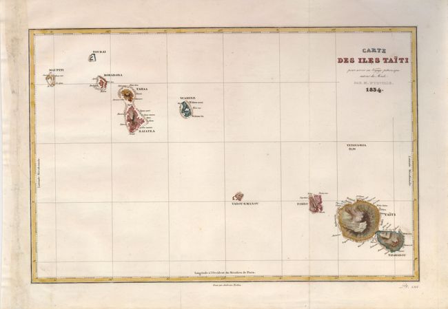
1) Carte des Iles Taiti… by Ambroise Tardieu, from "Voyage Pittoresque Autour du Monde…", 1834 (12.9 x 8.3"). This detailed map of the islands of Tahiti and the Society Islands was drawn for Dumont d'Urville's important first voyage of explorations in the Pacific (1826-29). The voyage returned to France with an impressive load of hydrographical papers and collections of zoological, botanical and mineralogical reports, which were destined to strongly influence the scientific analysis of those regions.
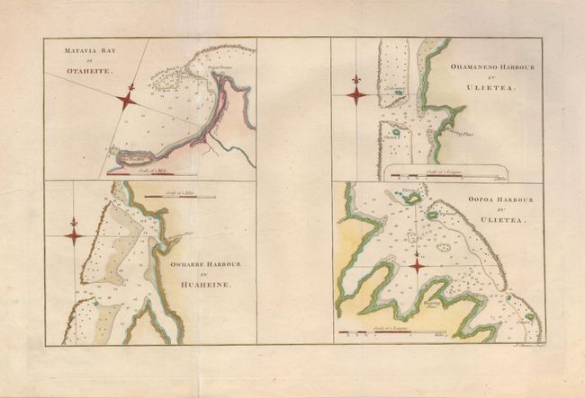
2) Matavia Bay in Otaheite et al, by from James Cook "An Account of the Voyages…" 1773, (13.8 x 8.5"). Four well engraved charts on one sheet that show four protected bays on the islands of Otahiti (Tahiti), Ulietea, and d'Huaheine. Each chart includes a compass rose.
References:
Condition: B+
Both issued folding, now flattened. 1) There are repaired binding holes in the left margin and a bit of light soil in the map. 2) Ther are a couple of extraneous creases.