Catalog Archive
Auction 126, Lot 670

"Turcici Imperii Imago", Mercator/Jansson
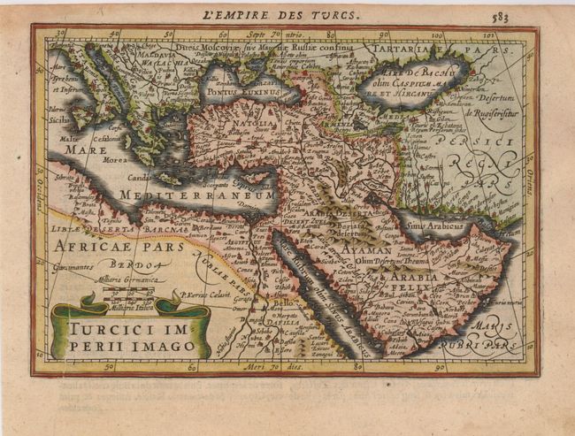
Subject: Eastern Mediterranean & Middle East

Period: 1628 (published)

Publication: Atlas Minor

Color: Hand Color

Size:
7.5 x 5.3 inches
19.1 x 13.5 cm
Download High Resolution Image
(or just click on image to launch the Zoom viewer)

Lovely small map based on Ortelius' map showing the extent of the Turkish Empire, which includes the Balkans, northeastern Africa, Arabia and all the Middle East. Title is enclosed in a ribbon-style cartouche. Engraved by Petrus Kaerius. French text on verso.

References:

Condition: A

There is a printer's crease on the leftt side of the map and some damp stains in the bottom margin.

Estimate: $160 - $200

Sold for: $140

Closed on 12/3/2008

Archived