Subject: Asia
Period: 1772 (dated)
Publication:
Color: Hand Color
Size:
47 x 20.3 inches
119.4 x 51.6 cm
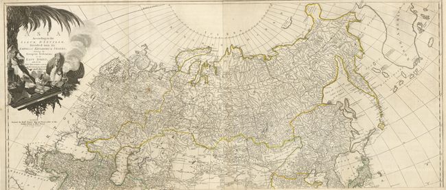
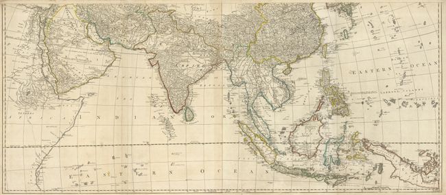
A superb, four-sheet map based on the cartography of the famous French cartographer Jean Baptiste Bourguignon d' Anville. It provides an extremely detailed view of the continent and extends to include all of South East Asia and numerous islands of the Pacific, with emphasis on English discoveries. While Kamchatka is represented relatively accurately, there is still imprecision in the North Asian coast. The Russian discoveries appear in the vicinity of Alaska, and the Dutch discoveries are shown in the region north of Japan. The Carolines are accurately depicted on an east-west axis. Evidence of Capt. Cook's voyage of 1770 is noted in the lower right corner in the "New Straits between New Guinea and New Holland." The large decorative cartouche features an Asian merchant, his exotic goods, and a camel. Printed on four sheets (joined to form two pairs) as issued. The map would measure 47 x 40.5" if joined.
References:
Condition: B+
Original outline color. A few short fold separations (some with paper tape repairs), otherwise very good condition for a map of this size.