Catalog Archive
Auction 126, Lot 397

"Carte de l'Isle de Sainte Lucie pour servir a l'Histoire Generale des Voyages", Bellin, Jacques Nicolas

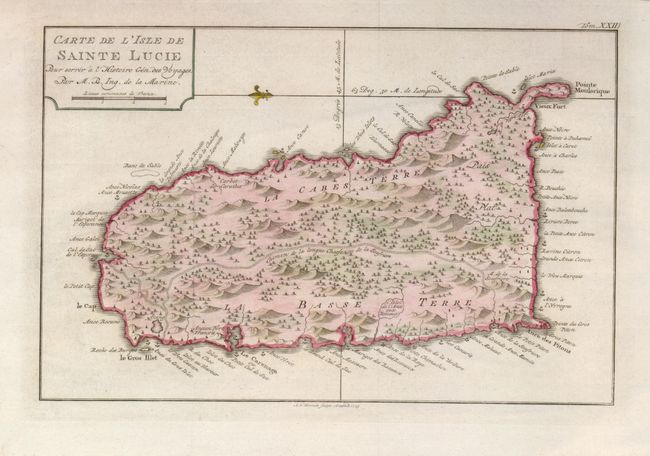
Subject: Lesser Antilles

Period: 1775 (dated)

Publication: Le Petit Atlas Maritime…

Color: Hand Color

Size:
11.8 x 7.5 inches
30 x 19.1 cm
Download High Resolution Image
(or just click on image to launch the Zoom viewer)

Crisply engraved map with graphic detail of this island in the Windward group. Scores of anchorages surround the island and topographical features are shown inland as is the long road. Old Fort Francois is located, but no town or village is depicted. Fleur-de-lys orients north to the left. Engraved by A. v. Krevelt in Amsterdam.

References: Tooley (MCC 81) #2; Phillips (A) #3508 v.1-95

Condition: A+

Great example with fine color and impression on delicate hand laid paper with wide margins.

Estimate: $180 - $220

Sold for: $100

Closed on 12/3/2008

Archived