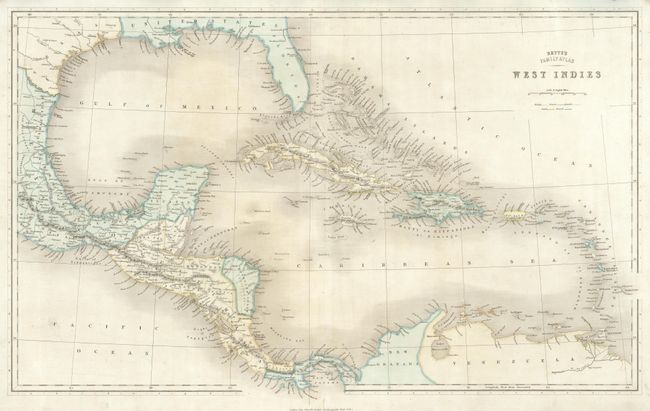
Subject: Gulf of Mexico, Texas, and Caribbean
Period: 1840 (circa)
Publication: Betts's Family Atlas
Color: Hand Color
Size:
24.5 x 15 inches
62.2 x 38.1 cm
This delicately colored map depicts the coastline of an independent Texas. Included in Texas are Houston, S. Antonio de Bexar, and Austin. The east coast of Mexico and all of the Yucatan, Guatimala, the Mosquito Coast (Independent), Costa Rica, and Panama are detailed. The islands of the Caribbean are well shown through the Windward's to Trinidad. Some coastal names exist along the Gulf in the United States and Florida, and the northern coast of South America. Legend shows colonial holdings via outline coloring.
References:
Condition: A
Near fine example original color and margins, good impression. Short marginal split in lower margin closed on verso.


