Subject: Wyoming
Period: 1900 (dated)
Publication:
Color: Printed Color
Size:
33 x 28.5 inches
83.8 x 72.4 cm
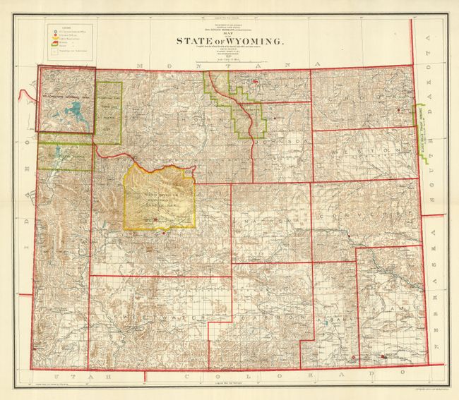
This is the scarce large edition GLO map of Wyoming. It is absolutely filled with details on a scale of 12 miles per inch. Legend locates Surveyor Generals Office in Cheyenne, the Land Offices, and the Indian, Military and Forest Reservations. Also indicates townships not subdivided, but there are very few at this point ten years after statehood. There are many early towns in the west including Pinedale, Big Piney, Jackson and Eldorado, but Alpine is not noted. The map has remarkable detail of watershed, topography shown in hachure, and Yellowstone National Park. Teton Forest Reserve is also shown to the south of Yellowstone. The Reserve was established by President Grover Cleveland in 1897 under the Forest Reserve Act of 1891. The area was designated the Teton National Forest in 1908 and in 1929 Congress established the region into the Grand Teton National Park. The state's organization is composed of thirteen counties plus the Big Horn Forest Reserve and a huge Wind River Indian Reservation in north-central Fremont County. Good detail of railways in southern portion of state. This is the large GLO issue not to be confused with the smaller, more common issue.
References: Blevins 572.
Condition: A
Folding as issued. Beautiful color and impression.