Subject: Virginia
Period: 1797 (published)
Publication: Morse's Universal Geography
Color: Black & White
Size:
7.5 x 5.6 inches
19.1 x 14.2 cm
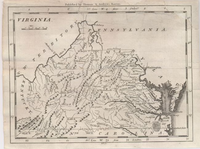
This map shows excellent detail of the various rivers and watershed. The map is nearly identical to the maps of Barker and Scott, but here the western boundary is not shown on either the East or West fork of the Big Sandy river. Ononcock is labeled Onaucook, again a similarity to the Barker and Scott maps. To the northwest is N.W. Territory. Published by Thomas & Andrews, Boston.
References:
Condition: B+
The map is backed with archival tissue to repair a split along a fold line and replace loss; expert manuscript facsimile completes upper right border.