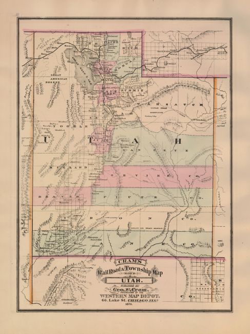
Subject: Utah
Period: 1879 (dated)
Publication: Cram's Standard American Atlas of the United States
Color: Hand Color
Size:
13.8 x 18.8 inches
35.1 x 47.8 cm
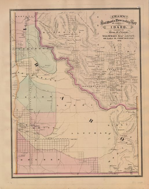
Rare map from the first edition of Cram's most celebrated atlas. This great map of Utah Territory shows early county development current to 1872. The large Great American Desert is shown west of the Great Salt Lake. Many small towns and villages are noted, several forts and the Uintah Indian Reservation. The railroad network is detailed including a spur which extends south to Nephi and Levan. On the verso is a fine map of Idaho which lists only eight counties. Idaho Falls is Eagle Rock and Boise City is the capitol. Locates Rocy Bar, Atlanta, Washington, Leesburgh and many more mining communities. The map carries the date of 1879 with a copyright date of 1878. The imprint is Cram's Western Map Depot, 66 Lake St. Chicago, Ills. There was a close relationship between the Cram and Watson firms, who also published from this address. This Lake Street address was the home to Cram's publishing company between 1873 and 1879, thereafter moving to Wabash Avenue.
References: Chicago Map Makers: "George F. Cram and the American Perception of Space" Gerald A. Danzer
Condition: A
Very fine hand coloring, dark impression and full margins. A hint of offsetting outside of left neatline.