Catalog Archive
Auction 126, Lot 336

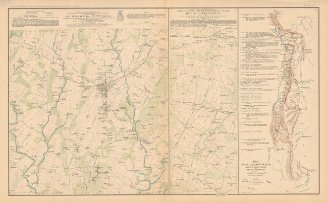
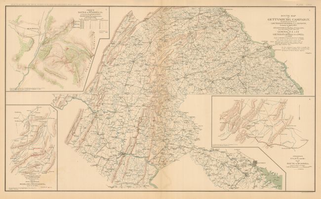
"[Lot of 2] Map of the Battle-Field of Gettysburg… [and] Route Map of Gettysburg Campaign", U.S. Army

Subject: Pennsylvania, Civil War - Gettysburg

Period: 1891-5 (circa)

Publication: Atlas to Accompany the Official Records of the Union and Confederate Armies

Color: Printed Color

Size:
27.3 x 16.3 inches
69.3 x 41.4 cm
Download High Resolution Image
(or just click on image to launch the Zoom viewer)

The first is Plate XCV, centered on Gettysburg, extending to show Round Top and Little Round Top to the south. The panel to the right is a continuation of the area further to the east on the same scale and aligned for easy study. The map carries incredible detail with the legend locating Stone Walls, Fences, Individual Trees (Pine, Oak, and Round Leaf), Houses, Churches, Outbuildings, burned houses, signal stations, and more. The second map is Plate CXVI which extends to locate York, Carlisle, Shippensburg, Hagerstown, Williamsport, Harper's Ferry, Frederick City, and Baltimore. A fine pair of maps related to the Gettysburg Battle.

References:

Condition: A+

Both are on much finer paper than we normally see from this atlas. A hint of offsetting in one place on each map, still fine.

Estimate: $100 - $150

Sold for: $60

Closed on 12/3/2008

Archived