Catalog Archive
Auction 126, Lot 294
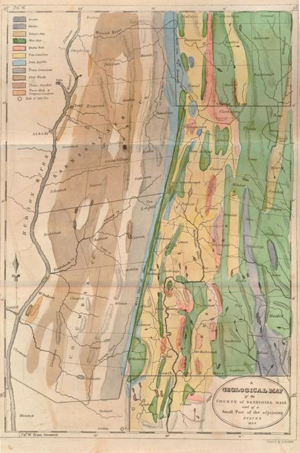
"A Geological Map of the County of Berkshire Mass. And of a Small Part of the Adjoining States", Doolittle, Amos

Subject: Massachusetts
Period: 1824 (dated)
Publication: American Journal of Science and Arts, Vol. VIII.
Color: Hand Color
Size:
7.8 x 11.5 inches
19.8 x 29.2 cm
Download High Resolution Image
(or just click on image to launch the Zoom viewer)
(or just click on image to launch the Zoom viewer)

