Subject: Kentucky and Tennessee
Period: 1834-56 (dated)
Publication:
Color: Hand Color
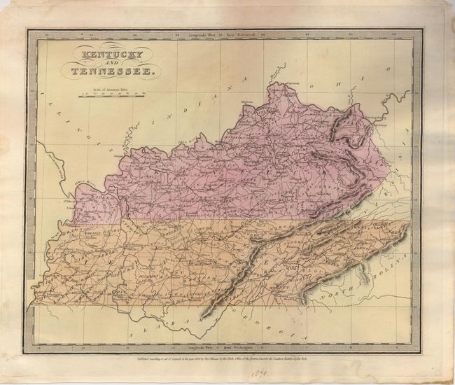
The first is Burr's map of the states with full original wash color and keyboard-style border. It delineates roads, towns, villages and settlements, ports, watershed and more. Counties are named but not individually colored. Burr was appointed to be topographer to the U.S. Post Office Department in 1832 and was unable to complete the maps for his atlas. Thomas Illman assumed responsibility to complete the atlas, publishing it in 1835 using the New York firm of D.S. Stone. The imprint of Thomas Illman is below the neatline. From the "Universal Atlas", hand color, 1834, (12.5" x 10.3"). A couple small spots near bottom and some marginal soiling or staining. (B+)
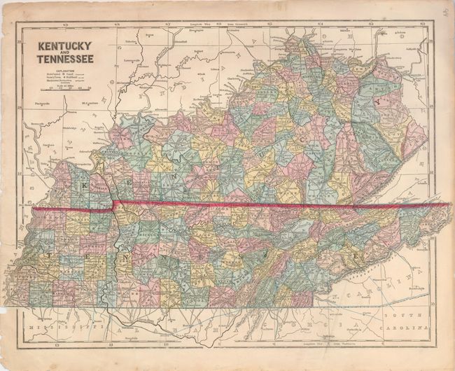
The second is an uncommon and early printed color map by Sydney Morse from his scarce "General Atlas of the World." Morse was a pioneer in the development of printed color on maps. The map is filled with details and all counties are individually colored. Printed color, 1856, (16.5" x 12"). Excellent impression and color. Left margin with some roughness and a tear. Some marginal stains or toning. (B+)
References:
Condition:
See individual descriptions.