Subject: California, San Francisco
Period: 1906 (published)
Publication:
Color: Hand Color
Size:
12 x 9 inches
30.5 x 22.9 cm
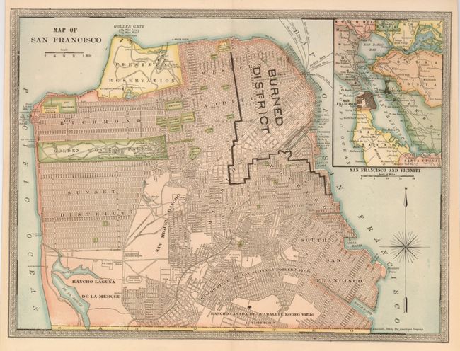
This great city plan was published by The Americana Company and is an early issue following the Great Earthquake and Fire of 1906. Black overprinting delinates the extent of the "Burned District." The fires burned for three days, consuming buildings in more than 500 blocks. All streets are named in this precisely engraved plan which extends south to below the South Basin and Rancho Laguna de la Merced. At upper right is an inset map "San Francisco and Vicinity." Blank verso. Fancy border and compass rose with long north arrow decorate the sheet. Dated 1905 but published 1906. An uncommon map from a scarce publisher.
References:
Condition: A+