Subject: California
Period: 1904 (dated)
Publication:
Color: Black & White
Size:
33 x 15.5 inches
83.8 x 39.4 cm
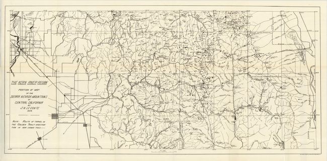
This map details the route of the scientific party led by Barton Warren Evermann to determine the habitat extent of the Golden Trout. Evermann was in charge of the Division of Scientific Inquiry of the Bureau of Fisheries for California. A note on the map gives the "Route of travel in the Golden Trout Investigation in 1904" via dash line. The map shows much of the Kern River watershed. Shows Visalia, Exeter and King's River at the extreme left and Mt. Whitney and Lake Owen in the east. The map is filled with details and it locates all tributaries, mountain peaks, mills, camps, settlments and post offices. At center is the "Giant Forest" of the Sequoia and the Sequoia National Park. Drawn by J.N. Leconte. A scarce issue.
References:
Condition: A+
Folding as issued.