Subject: California
Period: 1825-27 (published)
Publication: Atlas Universel
Color: Hand Color
Size:
22 x 19 inches
55.9 x 48.3 cm
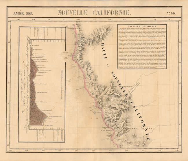
Sheet shows the coast from Monterey to the 42nd parallel, including San Francisco, Mendocino, and Port St. George. Two Native tribes are noted. A large French text block at upper right describes the richness of the land. The profile at the left shows the physical characteristics between Acapulco and Mexico City. The Atlas Universel was the first atlas to present all the maps on the same scale (1: 1,641,836), with each map covering an area of approximately 20 degrees longitude (from Paris) and 6 degrees of latitude. It was also considered to be the first lithographic atlas ever published. The maps were meant to be joined together to form a huge globe measuring 7.775 meters in diameter. There was only one edition of the atlas, published in 1825-27, and the subscription list shows that only 810 copies were sold. A scare issue.
References:
Condition: B+
An exceptional impression which has offset slightly. Original color and full, wide margins. Some uneven toning mostly at lower center.