Subject: Southwestern United States
Period: 1892 (published)
Publication: Atlas to Accompany the Official Records of the Union and Confederate Armies
Color: Printed Color
Size:
27 x 16.5 inches
68.6 x 41.9 cm
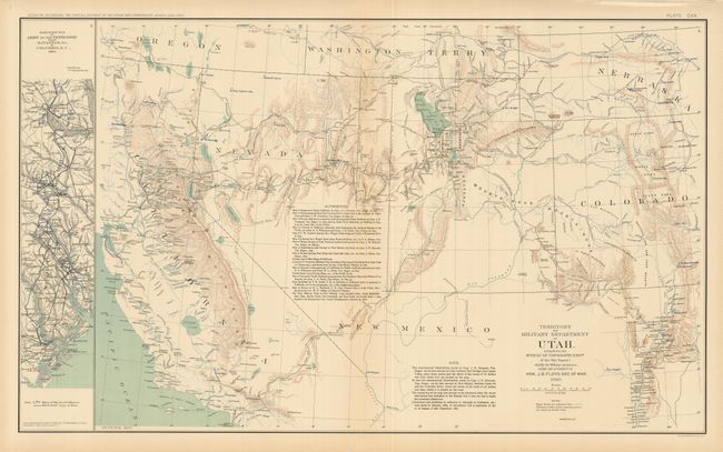
This map encompasses Utah and Nevada, as well as parts of New Mexico, present-day Arizona, Colorado, California, Oregon, Nebraska and Washington Territory (present-day Idaho). It shows considerable detail with the topography delineated in hachure. Locates Santa Fe and Fort Marcy, Salt Lake City, Denver City, Los Angeles, San Francisco, etc. Scores of forts are named, including: St. Vrains, Wingate, Camp Collins, Bonneville, Uintah, Ruby, Tejon, Reading, Bidwell, and camps McDermot and Summit Lake. Routes of various exploring parties are traced, with locations of forts, towns, watershed, wagon roads, and much more. Along the left is a strip map inset of "March Routes of the Army of the Tennessee from Savannah, GA to Columbia SC." The detailed list of Authorities notes 17 source maps used in the production of this map. The map is dated 1860, but was published in 1892.
References:
Condition: A
Faint toning and marginal fold separations repaired with archival tape.