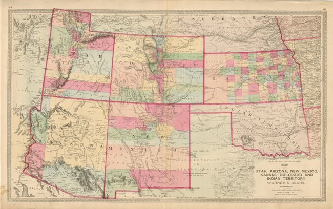
Subject: Southwestern United States
Period: 1870 (circa)
Publication: Atlas of the United States
Color: Hand Color
Size:
27.5 x 16.5 inches
69.9 x 41.9 cm
This is a great map of the southwest showing all counties in full hand color. Excellent detail of topography in hachure, watershed, towns and villages, railroads, forts, Indian Reservations, springs, watering holes, and more. Prescott is shown as the Capital of Arizona Territory. The Old Pony Express Route and Old Telegraph Routes are shown in western Utah. Also locates the Mail Route, various wagon roads including Salt Lake to Los Angeles. Colorado is filled with towns and roads attesting to the frantic mining activities. Details in Indian Territory include many Indian Lands, forts, and the "Disputed Territory" in the southwest. Blank verso. Maps by Warner & Beers are uncommon and this is no exception.
References:
Condition: A
Fine original coloring and good impression. Short split and a small tear in bottom margin.