Subject: Southwestern United States, Utah
Period: 1857 (dated)
Publication: Atlas of The United States of North America…
Color: Hand Color
Size:
16 x 13 inches
40.6 x 33 cm
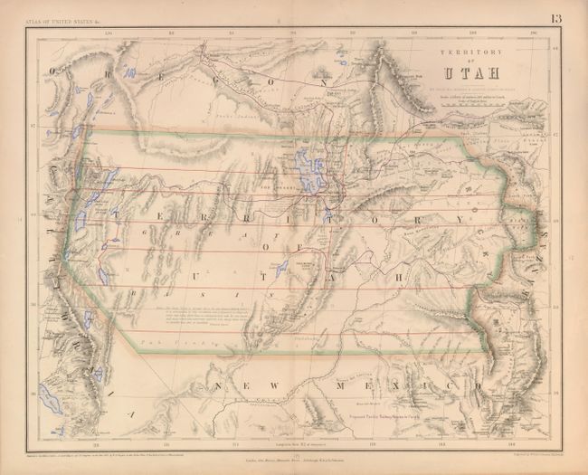
A fascinating and seldom seen map of Utah Territory from the rare Atlas of the United States. The map extends from eastern California to beyond the Rocky Mountains to western Kanzas, thus including much of today's Colorado. The territories of Oregon and New Mexico bound Utah to the north and south. It shows forts, topography, early roads, elevations, and much more. The map was produced using an interesting combination of printed and hand coloring; Utah, as well as the lakes, are outlined in hand color while Utah's few counties are delineated with printed color (red) and the railroads shown in purple. A long note in the map, credited to Fremont's Report, discusses the Great Basin's elevation, topography and its numerous land-locked rivers and lakes. The inhabitants are described as "savage tribes which no traveller has seen or described." Certainly one of the rarest of all maps of Utah Territory. It is derived from the large, rare wall map developed in an unusual collaboration between Prof. Rogers, an American, and the British publishing firm of Johnston. It was drawn by Prof. H.D. Rogers and A. Keith Johnston, and registered in Massachusetts by H.D. Rogers.
References:
Condition: A
A couple of minor edge tears have been repaired with tissue.