Subject: Western United States
Period: 1892 (circa)
Publication: Atlas to Accompany the Official Records of the Union and Confederate Armies
Color: Printed Color
Size:
27.5 x 16.5 inches
69.9 x 41.9 cm
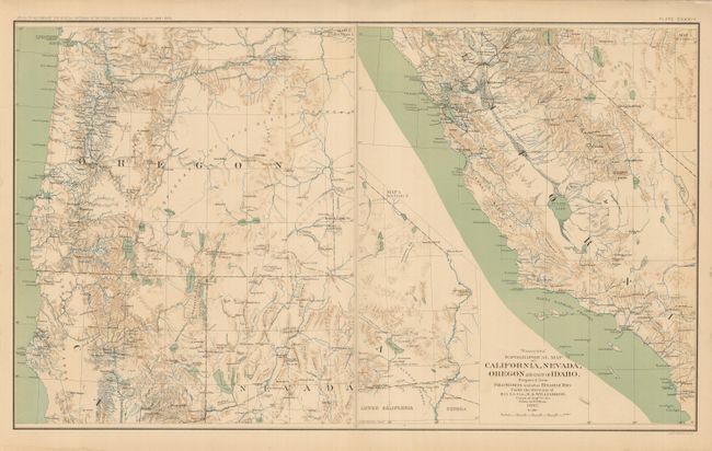
This large sheet has two maps. The map on the right (14" x 16.5") covers most of California from Yuba City south to the border with Mexico. The southeast corner of the state continues in a large inset on the same scale. Topography is shown via fine shading and watershed is shown via attractive blue overprinting. There is much military information: forts, barracks, wagon roads, etc. Drum Barracks is located next to Wilmington in Southern California. The left side of the sheet shows Oregon and the northern portions of California and Nevada in the same detail as the first. The full page is Plate CXXXIV. Dated 1867 but published 1892.
References:
Condition: A
Map image is fine, with just a little edge toning or staining restricted to edges. One short tear in lower margin, closed on verso. Beautifully colored and printed.