Subject: Colonial Southeast
Period: 1729 (published)
Publication: La Galerie Agreable du Monde
Color: Hand Color
Size:
14 x 11.3 inches
35.6 x 28.7 cm
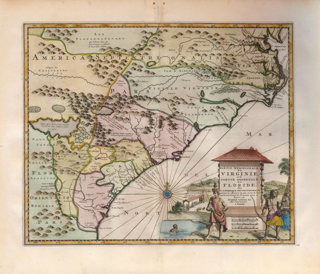
This is a very rare and attractive map of the American colonies stretching from Chesapeake Bay through the Carolinas. Geographically based on the Montanus map, which was in turn based on the Hondius/Blaeu model, and here amended with considerable detail from the Moxon/Ogilby map and other sources. The spurious lakes taken from the Lederer material appear in the mountains and there are two large Indian villages north of the large lake. The Carolinas are broken up into a number of large divisions taken from Delisle's Carte du Mexique et de la Floride…, 1703, and much of the nomenclature in the far western part of the map is also taken from Delisle. The large pictorial cartouche features Native Americans with their village in the background. The maps from La Galerie Agreable du Monde are rarely seen on the market, as only 100 copies of the 66 volumes of this incredible atlas were produced.
References: Cumming #205; Phillips (A) #3585.
Condition: A
There are some spots and a little paper loss in upper blank margin.