Catalog Archive
Auction 126, Lot 190

"Map of the Former Territorial Limits of the Cherokee Nation of Indians Exhibiting the Boundaries of the Various Cessions of Land…", Royce, C. C.

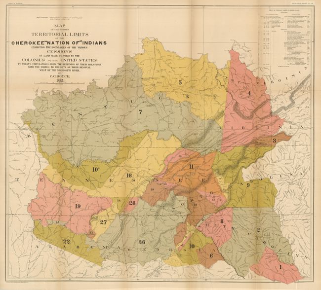
Subject: Southern United States

Period: 1884 (dated)

Publication: 5th Annual Report Bureau of Ethnology

Color: Printed Color

Size:
31.5 x 28.3 inches
80 x 71.9 cm
Download High Resolution Image
(or just click on image to launch the Zoom viewer)

The title continues, "...Made by Them to the Colonies and to the United States by Treaty Stipulations, from the Beginning of Their Relations with the Whites to the Date of Their Removal West of the Mississippi River" and shows the former territorial limits of the Cherokee Nation between the Ohio and Tennessee Rivers and the Appalachian Mountains. Key lists 36 cessions from 1721 to 1835 which are numbered and colored on the map. Showing many villages, forts and Indian Agencies, the map portrays an important period in Native American history.

References:

Condition: A

Folding as issued. Printed on thick paper with some fold splits as always seen on thick folded paper. One fold with very light toning, still very good.

Estimate: $200 - $250

Sold for: $250

Closed on 12/3/2008

Archived