Subject: Eastern United States
Period: 1784 (dated)
Publication:
Color: Hand Color
Size:
22.5 x 17.5 inches
57.2 x 44.5 cm
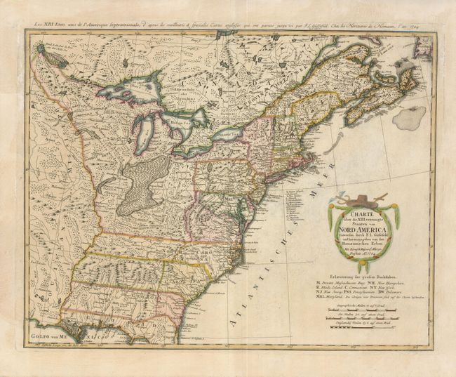
An early and large map of the newly formed United States of America delineating all 13 states. The map extends west past the Mississippi River and north to the southern tip of Hudson Bay, but the focus of the map is on the United States. The southern states are shown with their western boundaries on the Mississippi River, although the coloring shows only regions east of the Appalachians as being organized. As with many German maps of the period, there are some incorrect state boundaries; Vermont is shown as part of New Hampshire, and Maryland includes much of northern Virginia. A list of the principal German communities in New York, New Jersey and Pennsylvania are listed. The interior regions are shown with considerable topographical detail, locating numerous Indian tribes and watershed. The uncolored garland-style title cartouche is topped with a hat and crossed swords. The French title is outside top neatline: Les XIII Etats Unis de l' Amerique Septentrionale…
References: McCorkle #784-7; Sellers & Van Ee #757.
Condition: B+
There is some faint printer's ink residue in the map, a printer's crease along the bottom centerfold, and a short fold separation in the top margin, not near the map.