Subject: United States
Period: 1825-1875 (circa)
Publication:
Color: Hand Color
A great lot of 19th century maps showing the transitional borders of the United States.
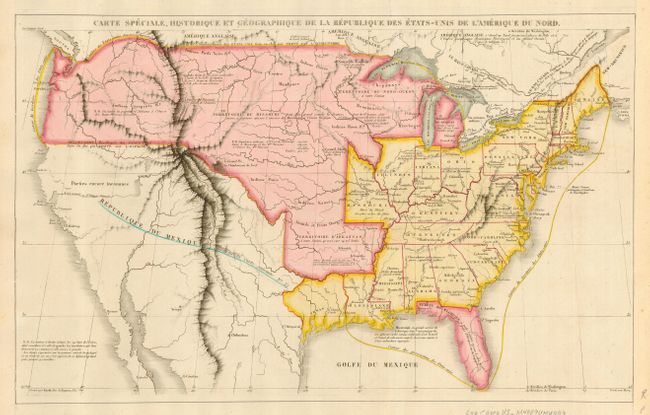
1) The first is by Jules Renouard, circa 1825. This interesting map shows a rather uncertain border with Canada, favoring US claims. Shows Florida, Michigan, Arkansas, and Missouri Territories, plus the old Northwest Territory. Texas is named and colored the same as the US, but is shown separate from the US and Mexico. Arkansas Territory is huge and has an uncertain northern extent. A number of Native American tribes are located. Missouri's state capitol of Jefferson City also has its proposed name of Missouriopolis. The map's cartography is mostly based upon Humboldt, especially in Upper California and Texas. The surrounding text in this example has been trimmed away. A scarce map. (16.8 x 10.5"). Paper laid in at sides to replace trimmed text, otherwise fine example.
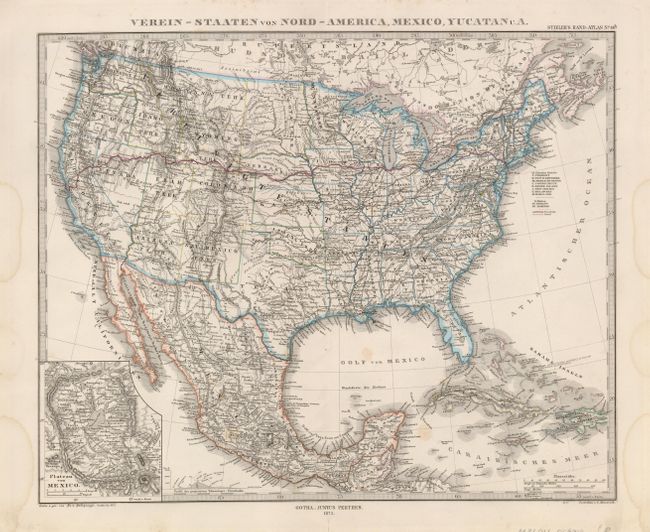
2) The second is a handsome map with crisply engraved lines that extends to include all of Mexico and the Caribbean to St. Domingo. Washington, Idaho, Wyoming, Montana, Utah, Arizona, New Mexico and Dakota are noted as territories. An inset details the Plateau von Mexico including the salt marsh of the Texcoco Lake (Texcuco See). Published in Stieler's Hand-Atlas in 1875 in Gotha by Justus Perthes. (15.5 x 12.6") Original outline color on a sturdy sheet with a few faint stains in the map and margin.
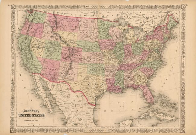
3) The third map by Johnson shows the boundaries of Nevada, Arizona, Utah and Dakota territories that existed for only a short period of time in the turbulent period following the Civil War in 1864. Wyoming is unformed and presumably attached to Dakota. The track of the Pony Express, Fremont's route of 1844, the routes of the transcontinental railroads, locations of army forts etc. are added features of interest shown on the map. The map is surrounded by a decorative border. Published by A. J. Johnson in New York (23.2 x 17"). Brittle margins have been trimmed but still show some chips. Map image is good but the map is fragile.
References:
Condition: B+
See individual descriptions.