Catalog Archive
Auction 125, Lot 850

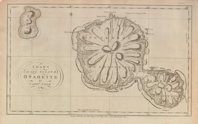
"Chart of the Island Otaheite", Cook/Hogg
Subject: Tahiti

Period: 1785 (circa)

Publication: A New, Authentic, and Complete Collection of Voyages Round the World…

Color: Black & White

Size:
14 x 8.5 inches
35.6 x 21.6 cm
Download High Resolution Image
(or just click on image to launch the Zoom viewer)

Based on the 1769 survey of Capt. Cook, this map provides a fine view of the dramatic topography of the islands of Tahiti. Cook's mission on his first voyage to the South Seas was to observe the passage of Venus across the Sun in 1769, at the request of the Royal Society. Point Venus is shown at the top of the map as the northernmost point on the large island.

References:

Condition: A

Lightly toned paper with a nice impression.

Estimate: $120 - $150

Sold for: $95

Closed on 9/24/2008

Archived