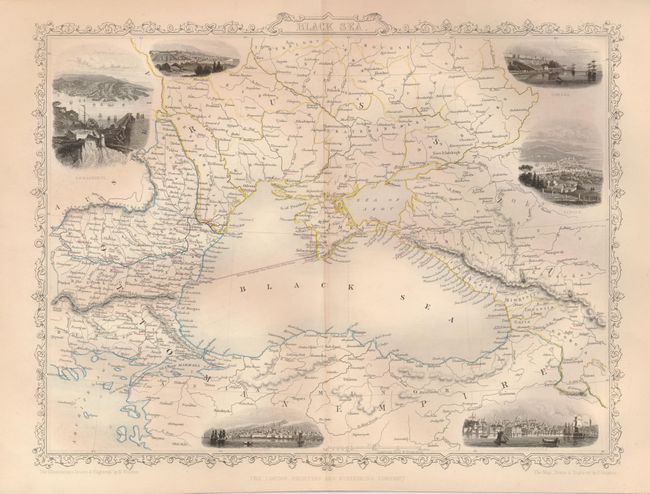
Subject: Black Sea
Period: 1855 (circa)
Publication: The History of the War with Russia
Color: Hand Color
The maps from The Illustrated Atlas were first published in serial form to a target audience that led insular lives due to the expense and hardship of travel. All that changed as the progress of the nineteenth century brought swift and dramatic changes in public awareness of far away places. Tallis' maps no doubt played an important role in this dramatic awakening. These maps not only provided up-to-date geographical knowledge, but also used vignette views within the map's design to show the native people and their occupations, cities and points of interest. The maps hark back to a cartographic tradition from the Dutch mapmakers of the seventeenth century with finely engraved decorative borders. The maps were drawn and engraved by John Rapkin with views drawn and engraved by a number of prominent artists. The maps were issued as a complete volume from 1851 until about 1865. Some of the maps were also published in other history books published by Tallis including British Colonies and, without the vignettes, in geographical dictionaries and encyclopedias until about 1880.
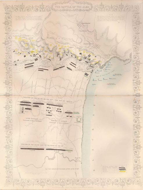
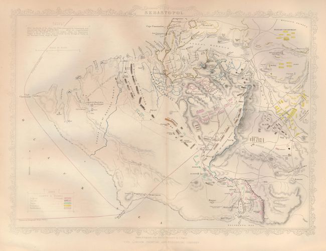
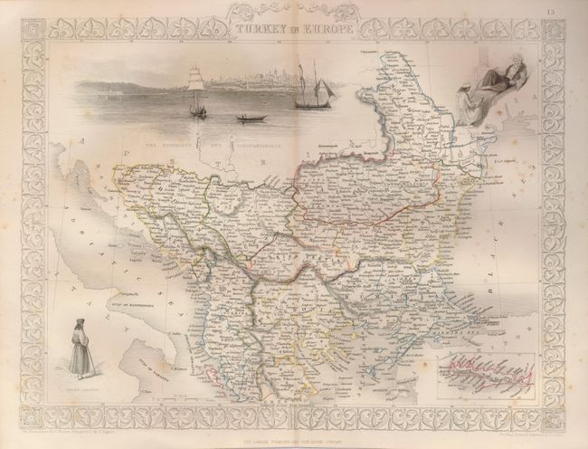
These steel engraved maps illustrate the regions embroiled in the Crimean War, known in Russia as the Eastern War. The war was fought between the Russian Empire on one side and an alliance of France, Britain, the Kingdom of Sardinia and the Ottoman Empire on the other. Most of the conflict took place on the Crimean Peninsula. The maps are finely engraved and surrounded with delicate fancy borders.
1) Black Sea (12.5 x 10"), with vignettes of Sebastopol, Odessa, Sinope, Constantinople and Silistria.
2) Plan of the Battle of the Alma (10 x 13.5"), color identifies British, French, Turkish and Russian forces.
3) Siege of Sebastopol (13 x 9.5"), color identifies English, French, Turkish, Russians, and Sardinian forces.
4) Turkey in Europe (13 x 9.8"), with vignettes of The Bosphorus and Constantinople, Ali Pasha and Greek Caloyer.
References:
Condition: A
Original outline color. All very good except some light foxing on #4.