Catalog Archive
Auction 125, Lot 612

"Etats de Boheme, divises en toutes leurs Provinces, tant Civiles qu'Ecclesiastiques", Brion de la Tour, Louis

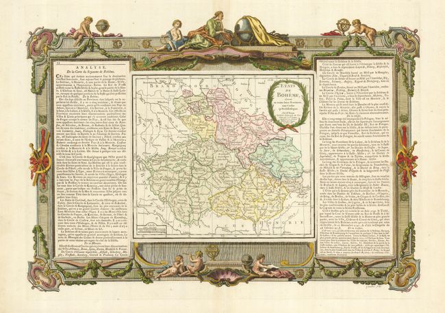
Subject: Czech Republic

Period: 1766 (dated)

Publication: Atlas Generale…

Color: Hand Color

Size:
22 x 15.5 inches
55.9 x 39.4 cm
Download High Resolution Image
(or just click on image to launch the Zoom viewer)

This copper engraved map covers modern-day Czech Republic with parts of southern Poland and Slovakia. The map (10 x 9") is on a beautifully engraved sheet with text panels at both sides, all surrounded by elaborate borders that include scenes of putti, globes, instruments, etc.

References:

Condition: A+

Fine impression and original margins with extremely lovely later color on the border. Fine, except for a small, unobtrusive spot between text and border at right.

Estimate: $200 - $250

Sold for: $150

Closed on 9/24/2008

Archived