Catalog Archive
Auction 125, Lot 603

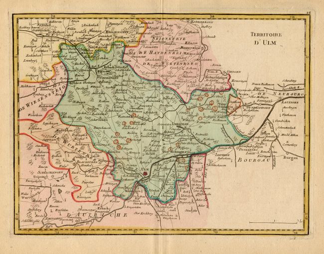
"Territoire d'Ulm",

Subject: Germany

Period: 1759 (published)

Publication: Atlas Portatif…

Color: Hand Color

Size:
10.9 x 8.2 inches
27.7 x 20.8 cm
Download High Resolution Image
(or just click on image to launch the Zoom viewer)

A beautifully engraved map covering a small portion of Braden-Wurtemberg and Bavaria, roughly centered on Ulm and the Danube River. Very detailed naming scores of villages, it extends to include Lauingen, Gundelfingen, Weissenstein, Goppingen, Geislingen, Blaubeuren and Erbach.

References:

Condition: A

Lovely impression and original coloring on thick paper with full margins.

Estimate: $100 - $120

Unsold

Closed on 9/24/2008

Archived