Subject: France
Period: 1771 (dated)
Publication: Atlas General Methodique et Elementaire
Color: Hand Color
Size:
21.5 x 14.5 inches
54.6 x 36.8 cm
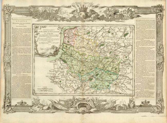
A decorative and finely engraved copper-plate map of the region bounded by Normandie to the west, Flandre to the north, l'Isle to the south and Champagne at the southeast. The surrounding departments and towns include Rheims, Beauvais, Rouen, Dieppe, Abbeville, Amiens, Arras, Calais, Namur, and more. The map is flanked by two columns of French text on separate laid paper, as was the practice with this series of maps. The sheet is embellished by a wide rococo-style frame with a military theme. The map (13.6 x 9.5") and decorative border were printed from two separate plates and assembled with the text for this beautiful atlas. Map is fully colored; cartouche and decorative border are uncolored as issued.
References:
Condition: A
Beautiful impression, fine original hand coloring and full margins.