Subject: United States, Texas & Mexico
Period: 1847 (dated)
Publication:
Color: Hand Color
Size:
21 x 28 inches
53.3 x 71.1 cm
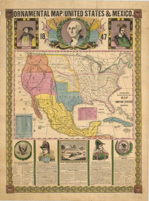
Beautiful pair of large, colorful patriotic broadsides. The first, an Ornamental Map of the United States & Mexico, is a great map of the two countries featuring the new, enlarged state of Texas. Bright colors delineate political boundaries and boldly mark the route of the "Great Oregon Rail Road" from New York to Oregon City. Portraits of Cortez, Washington, and Montezuma appear above the map; below are the great seals of the United States and Mexico, portraits of generals Taylor and Santa Anna, and a view of an Aztec temple. Text describes the history of the region culminating with the Mexican American War and showing the United States in possession of New Mexico and the Californias despite the fact that the war had not yet ended at the time of publication.
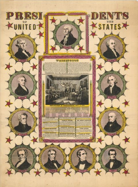
The accompanying broadside features eleven portraits of presidents (Washington to Polk) surrounding a view of the signing of the Declaration of Independence and brief biographies of each of the presidents. These highly decorative and overtly patriotic broadsides are typical of the works produced by Phelps in partnership with the lithographers, Timothy and Edward Ensign and Horace Thayer.
References: Wheat [TMW] #551.
Condition: B+
Each has some moderate soiling and extraneous creasing. The map of the U.S. has an old repaired 5" tear into the top border. Both have a few small wormholes. Still very nice examples in remarkable condition for this type of material.