Subject: New Mexico
Period: 1901-03 (dated)
Publication:
Color: Printed Color
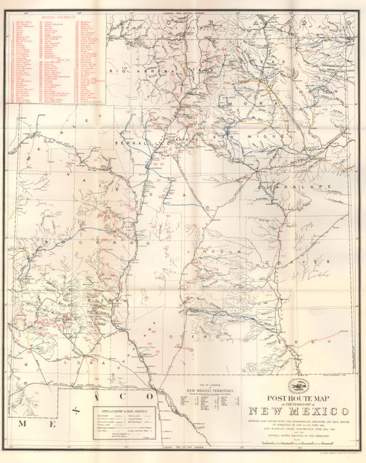
1) Norris Peters Co., 1901, (17 x 21"). Very interesting and detailed map of the territory showing the post offices and mail routes in operation. The routes are shown with different colors to depict the frequency of service, from once a week to six times a week. It also shows railways under construction. Table in upper corner names 116 mining districts that are numbered and located throughout the map. Above the title, the logo of the Post Office Department shows a pony express rider and a train.
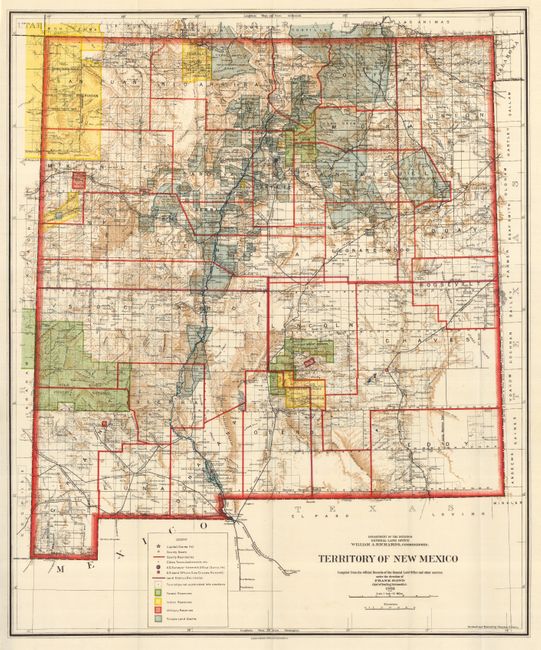
2) General Land Office, 1903, (18 x 22"). A colorful and fascinating map published only nine years before New Mexico obtained statehood. Shows in incredible detail the extent of existing Indian reservations, Military reservations, Forest Reserves and Private Land Grants through color and hash. Mountains shown by a brown hachure plus all the other colors on the map combine to provide great visual impact. Filled with information on watershed, mountains, railroads, wagon roads, unsurveyed townships, etc. Delineates the short-lived county of Leonard Wood. In 1903, Guadalupe county was renamed Leonard Wood and then reverted to Guadalupe in 1905. The map was compiled by Frank Bond, Chief of Drafting Division.
References:
Condition: A+
Both folding as issued and flawless.