Subject: Missouri
Period: 1825 (published)
Publication: Atlas Geographique, Statistique, Historique et Chronologique…
Color: Hand Color
Size:
9.5 x 11.5 inches
24.1 x 29.2 cm
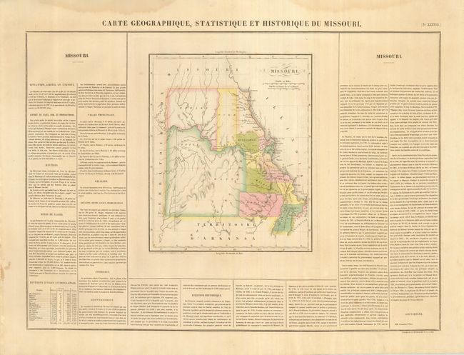
Lovely map from the French edition of Carey and Lea's American Atlas. Missouri has 15 counties with those west of the Ozarks notably large; a large unorganized region in the southwest represents about a third of the state.. The state is remarkably unsettled just four years after attaining statehood, with the few towns lying along the Missouri and Mississippi Rivers. The full folio sheet (27 x 21") includes French text on three sides describing the history, government and population. The population table lists numbers of whites, free blacks and slaves. The map was originally engraved by Young & Delleker in 1822, and published by Carey and Lea. This is the French version issued in Atlas Geographique.
References:
Condition: A
A beautiful example with fine original coloring and very wide margins. Light water stain in blank upper margin.